
Surveying, Cadastre, Geographic Information Systems > Surveying, Cadastre, Geographic Information Systems> Completion of the new Railway Line of standard width, between Korinthos - Patra, from k.p. 59+000 to k.p. 75+000 (Akrata - Diakopto).
Tasks that have been performed according to the contract:
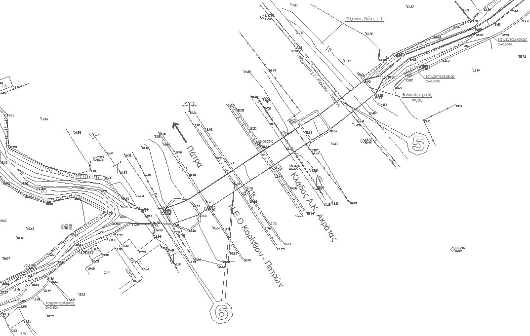
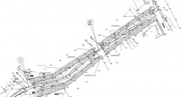
- Update and produce electronic topographic background in scale 1:500 along the passband of the new Railway Line and the horizontal and vertical road network. These were performed under the existing photogrammetric charts of scale 1:500 and the cadastral diagrams drawn within the approved preliminary design making.
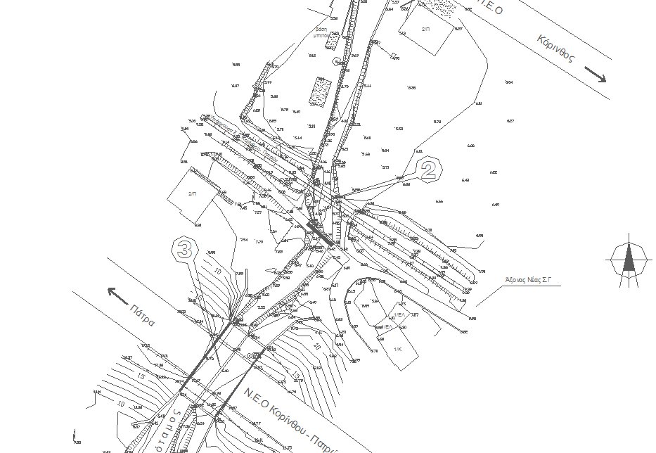
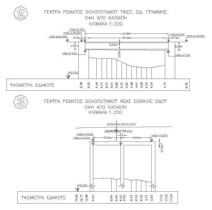
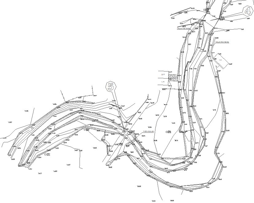
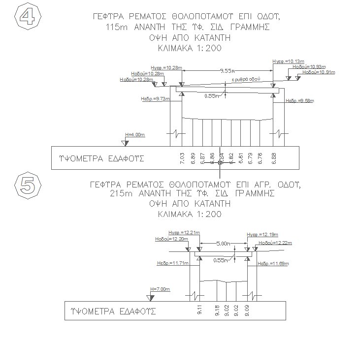
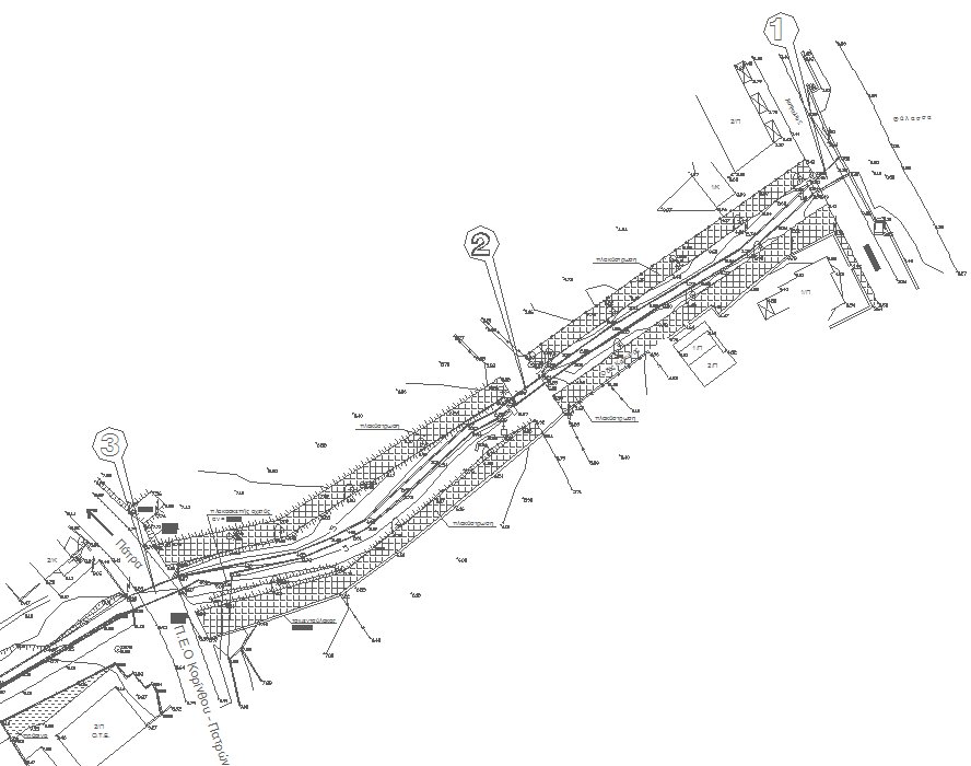
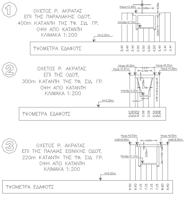
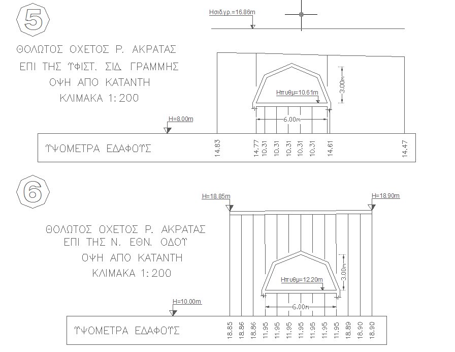
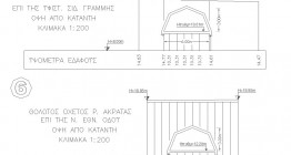
- Topographic mapping in scale 1:200 of the study design areas of large engineering structures (bridges and tunnel fronts).
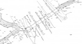
- Topographic mapping in scale 1:200 of the output areas of escape tunnels Platanou-Trapezas.
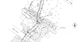
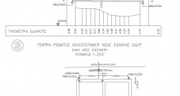
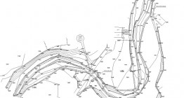
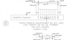
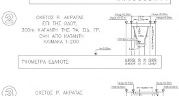
- Additional surveying at the riverbeds Tholopotami, Krathi and small streams (k.p.60+500) for the needs of the hydraulic study, as well as topographical operations to determine drilling positions.
Client: ERGA OSE SA /


-
 Φώτο: 410-1
 -
 img_65_410-2
 -
 img_66_410-3
 -
 img_67_410-4
 -
 img_68_410-5
 -
 img_69_410-6
 -
 img_70_410-7
 -
 img_71_410-8